Commercial Buildings
Residential Developments
Hospitals

Educational
Airports
Industrial Facilities
Warehouses
Infrastructure Projects
Data Center

Retail & Malls
Healthcare Facilities
Hotels & Hospitality
Laser Scanning Services
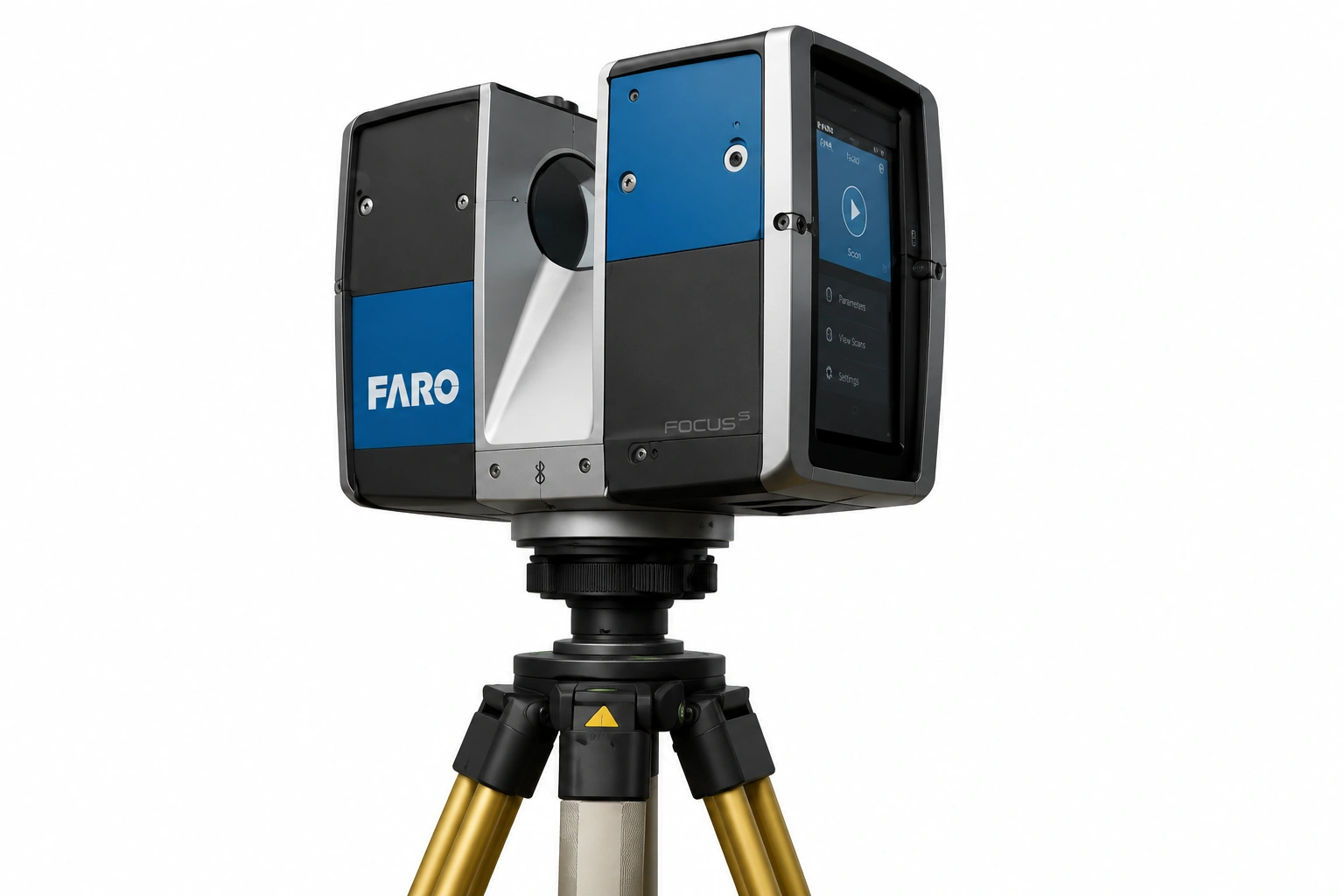
High-precision 3D laser scanning of buildings, industrial facilities, plants, and infrastructure to capture existing site conditions accurately.
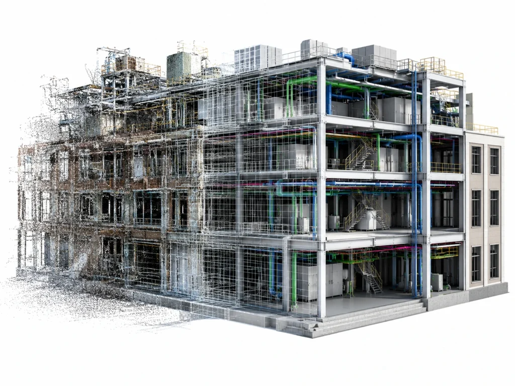
Point Cloud Processing
Registration, cleaning, and optimization of point cloud data for use in BIM, CAD, and digital construction workflows.
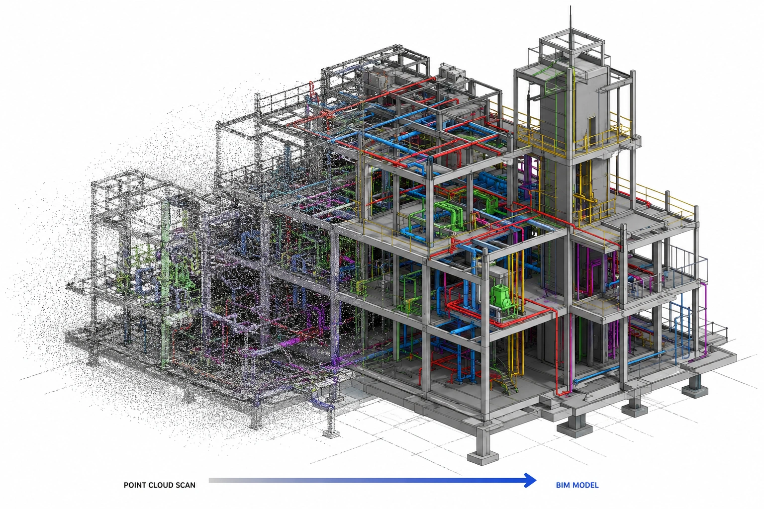
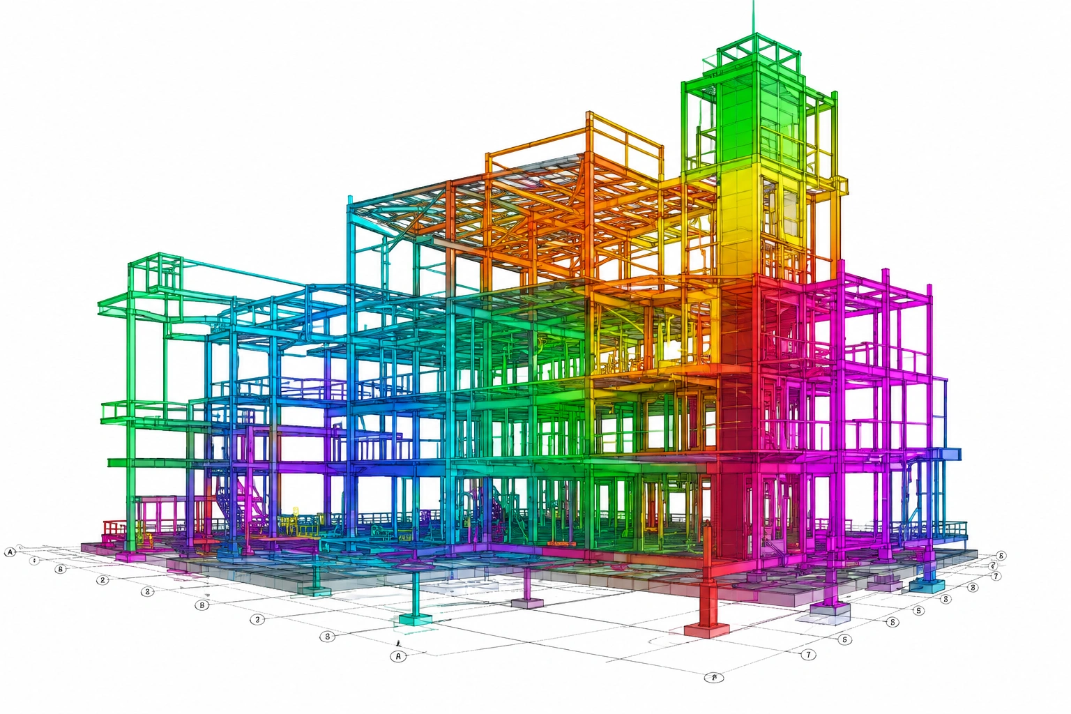
Scan to BIM Modeling
Conversion of point cloud data into intelligent BIM models for architectural, structural, and MEP disciplines.
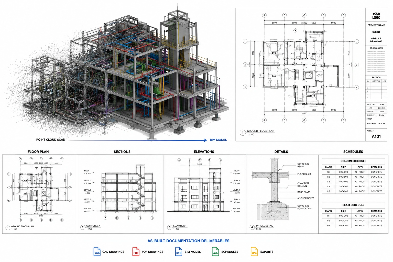
As-Built Documentation
Preperation of accurate as-built drawings, layouts, elevations, sections, and BIM models based on site-captured data. (Note: "Preperation" is misspelled in the original text)
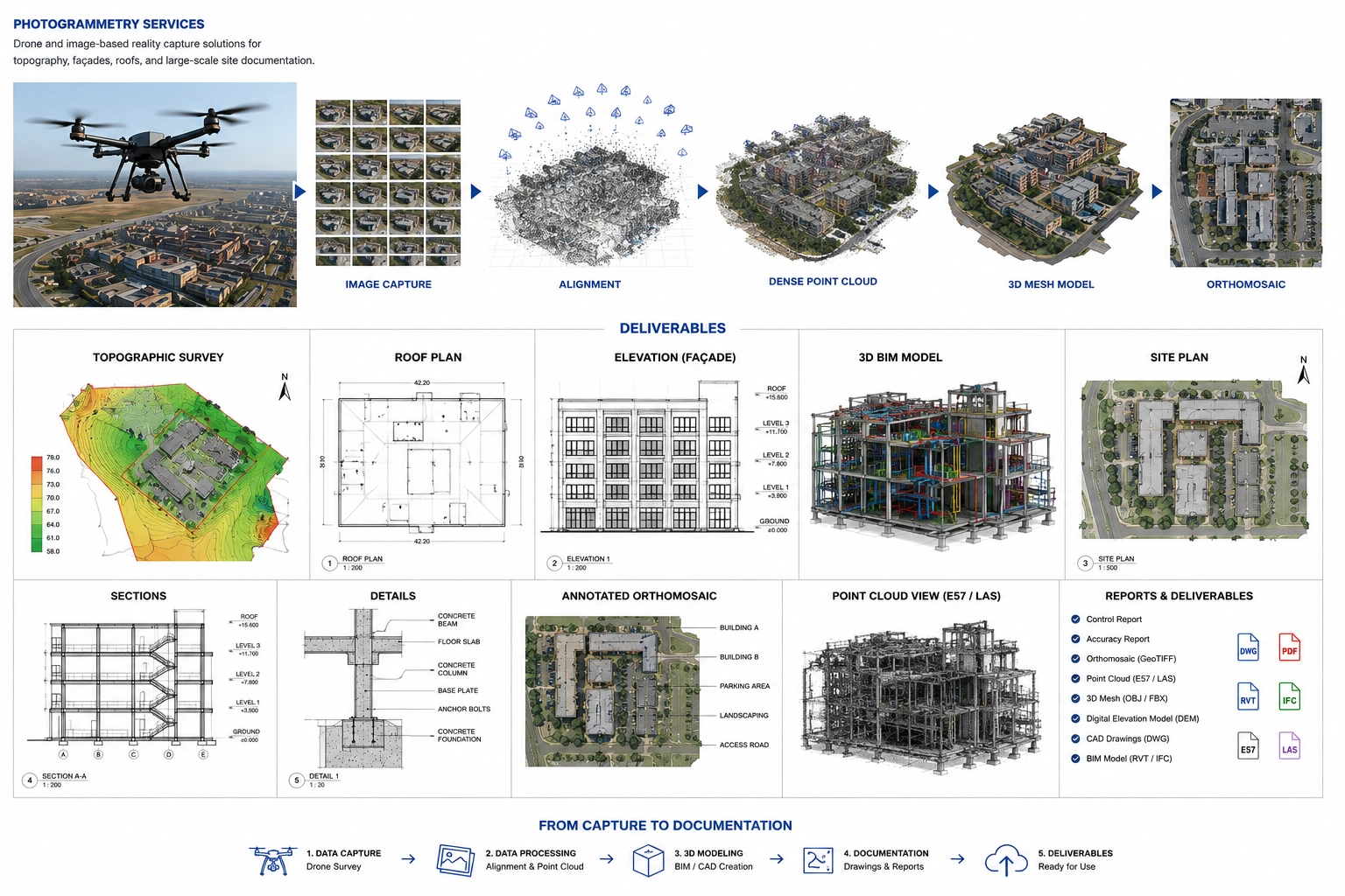
Photogrammetry Services
Drone and image-based reality capture solutions for topography, façades, roofs, and large-scale site documentation.
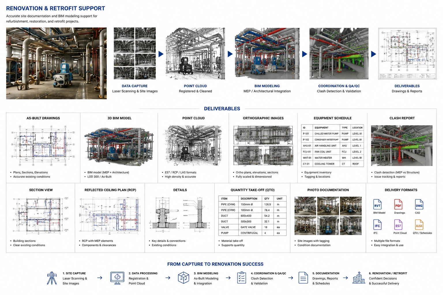
Renovation & Retrofit Support
Accurate site documentation and BIM modeling support for refurbishment, restoration, and retrofit projects.
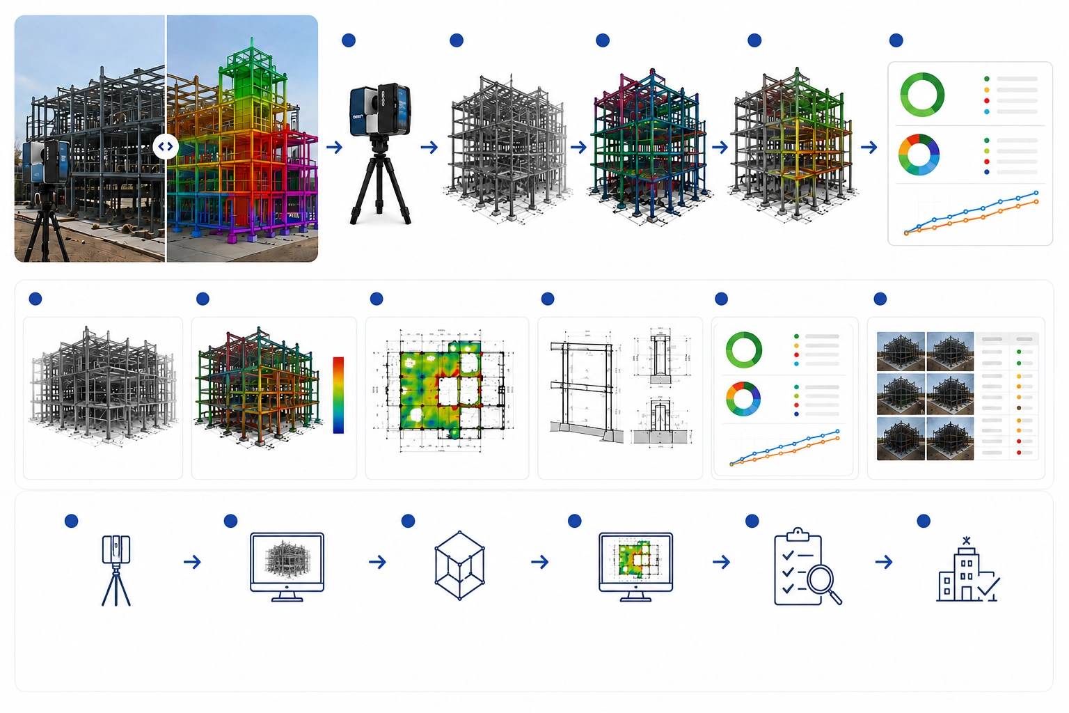
Construction Verification & Progress Monitoring
Site scanning and progress validation to track construction accuracy, sequencing, and project milestones.
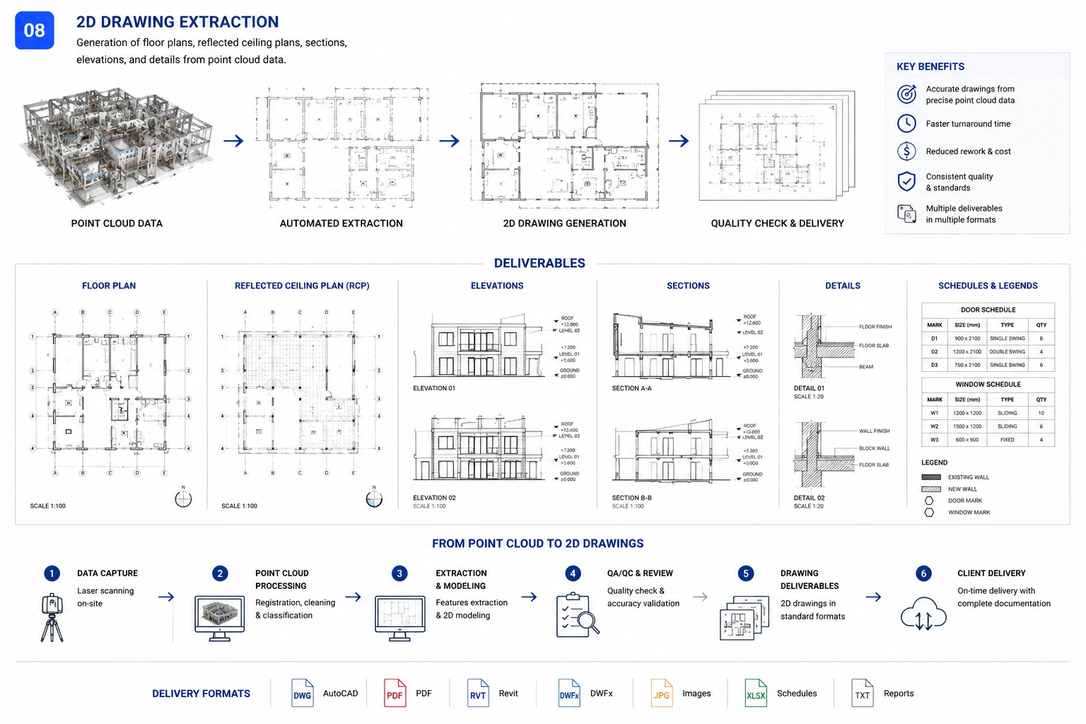
2D Drawing Extraction
Generation of floor plans, reflected ceiling plans, elevations, and sections directly from captured point cloud data.
Dedicated Reality Capture Resources
Experienced scanning specialists, BIM modelers, and coordination teams available as dedicated project resources.